Sunday, July 31, 2016

In which I drive too far, but it's all worth it

- - - - - - - - - - -
Still getting caught up. Still appreciating every moment!
- - - - - - - - - - -
Staying a second day at the Paxson Lake Campground was a good thing. The rain finally abated, so that the tarp had a chance to dry out. So glad I didn't have to put it away wet! 

The "real" Alaska

Devices

Charging from the solar panel
One of the good things about staying at Paxson was that I was able to get everything charged up using the big folding solar panel.

With so much traveling (and so much rain), I hadn't really had a chance to lay it out and use it, even three months into this trip. But now, since I wasn't driving at all, devices couldn't be charged off the car battery, so if they are used, the batteries are drained.

Turned out the solar panel was AWESOME. It worked, charging up my iPhone, Kindle and iPad, even though there was no "real" sun, just "cloudy bright." I'm really pleased with the speed that it charged everything up, too! Yaay for technology!

Decisions

If truth be known, I wasn't exactly sure what I wanted to do on this excursion on the few days before Fran was due to arrive late on Aug. 2. My original plan had been to drive the Denali Highway east to west from Paxson to Cantwell by myself, then drive the "big loop" out of Fairbanks south to Glennallen with Fran.

However, I didn't quite plan ahead well enough, and hadn't filled up on gas when I should have. Now that I was here, and there was no gas at Paxson (the lodge burned), I was nervous about the 135 miles of gravel/dirt road taking that route; it was only 73 miles along the Richardson Highway to the next reliable gas at Glennallen.

This was going to mean driving quite a bit farther this time around, but I had the time, the weather still wasn't that great, and I figured that maybe I could do the Denali Highway with Fran.

Nothing like being flexible and coming up with a new plan!

The Gulkana River at near Sourdough, AK
The last raspberry

Gulkana River

The Richardson Highway meets up with the Gulkana River (not to be confused with the Gulkona River from a few days ago, which originates out of the Gulkona Glacier).

The Gulkana flows south to join with the much larger Copper River, which in turn gathers water from the Wrangells and keeps flowing south to the Gulf of Alaska. I had some interest in this area, anyway, as the thesis project I was supposed to work on oh-so-many years ago if I had gone to the University of Fairbanks, was the effects of copper mining on the water quality of the Copper River.

(Coulda, shoulda, but I'm not thinking about that too much. Really. Well, sort of not.)

Here, however, the Gulkana is a National Wild and Scenic River. The Sourdough campground was not nearly as pleasant as Paxson, but it is a favorite put-in and take-out spot for canoeists and rafters and fishermen, and would make a pleasant place to recover from a trip or get ready to leave.

There is also a nice expansive picnic area, and a nature trail along the river. It was good to get out and walk and have some lunch, especially since it wasn't raining!

I'm filing the rafting information on the Gulkana River (managed by the BLM) for another trip. It's enough to make one drool! I'd love to see river otters playing along the bank, and eagles flying overhead! There are interesting cliffs by the side of the river, and some walking trails that are easily accessible from the highway...

As Arnold said (and is a continuing refrain), "I'll be back."
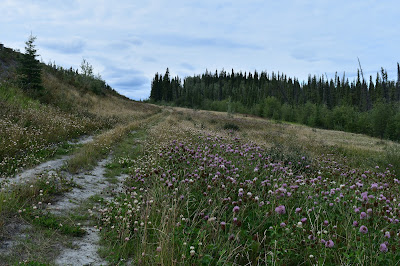
Unassuming field of clover

Clover

On my way to Gennallen and gas, I saw a bright yellow float plane on a marshy pond, with low hills in the background, and it all just shouted "ALASKA!" to me, especially since reading the Moosejaw series. I could just imagine a hidden cabin nearby where Gus lived, and Haywood bringing supplies in his plane

One of the great things about traveling by oneself is that you can stop anywhere you like, any time you like, without regard to someone else's interest, or need for food or sleep!

Spectacular (and unexpected) forms in clover. Like little fireworks!
Wanting a photo (although I will long remember the sight), I pulled a "U-ey" and found a place off the side of the road where I could park. Luckily, the highway is not crowded.

I had to walk through a field to get to where I thought I might be able to get a good picture.

The air was filled with a heady fragrance, but I didn't pay too much attention, as I was focussed on getting the photograph, which turned out to be a bust: there was no way that I could get the shot I had envisioned. The angles were all wrong: either I was too low on the hillside with no way to climb up, or a tree was in the way, or the plane was behind a hill.

Just didn't work.

Still, I took the picture that I could, just because it will remind me that sometimes art can trump photography, because with artistic license, you can MAKE the picture what you envision!


On the way back, I was free to look around, and I realized that (duh) the field was full of clover.

In looking more closely (another refrain that by now will be familiar to my readers), I saw that there were many different types and colors of clover!

There was pink clover, white clover, purple clover and bi-color clover. Clover with ruffled petals and folded petals.

Budding clover, half-blown clover, clover almost going to seed.

Clover with green leaves, mottled leaves, and brown leaves.

I went a little crazy, wanting to capture everything, and with the hopes of maybe drawing these some day.

Suffice to say that I will never, ever, look at clover the same way again!

Glennallen

The Richardson Highway ends at Glennallen.

Late on a Sunday afternoon, it was a busy place. The gas station at the crossroads of the Richardson and Parks Highways was doing a land-office business.


Alaskans from Anchorage and Fairbanks and anywhere else, it seemed, were on their way home from a weekend of fishing and playing in the outdoors. Boats, trailers, RVs, bikes, motorcycles... all were filling up their vehicles for the dash home.

Flowers and vegetables outside the Visitor Center
The gas station had a gift shop and convenience store, filled with everything Alaskan: posters, patches and pins; blueberry and birch syrup; antler and horn knives, beaded moccasins, bandanas, mugs and wood bowls; jade, bone and gold earrings, rings, pendants and bracelets; ice cream bars, burritos, milk and sandwiches.

I bought ice because I needed it and wasn't sure what was ahead. Kind of gulped at the $5.99 price, but it's better to get more ice than have the food in the icebox go bad.

There's not a whole lot to Glennallen (it's a "census-designated place" with a population of less than 500), but there is a well-stocked grocery store, a library, and a post office: all the essentials for a small town. It is something of a locus for community, like Delta Junction is to the east. There are some hotels offering respite from the road, and the Dept of Fish and Game has an office here. There is a Visitor Center, and the local Native American corporation has a presence here, too.

During the evening, I went to the library to use their wifi, still operating even though they weren't open. There was a nice picnic table just outside, and it was pleasant enough to sit and write despite annoying mosquitoes. 24/7 wifi is a real draw for a small town like this; there was a constant stream of travelers and locals coming by to use it.

But more on that tomorrow!

Saturday, July 30, 2016

Kicking back at Paxson Lake

- - - - - - - - - - - - -
Please bear with me with these catchup posts! I'm making progress!
- - - - - - - - - - - - -
Paxson Lake turned out to be a welcome respite from near constant travel. My time there was the closest thing yet on this trip to what I thought (or hoped) this trip would be like, even with the rain and mosquitoes!

Different type of fireweed at Paxson Lake (note the silver leaves and red veins in the petals)

Paxson Lake: almost heaven

After arriving and choosing a campsite, I took it easy. Set the tarp up to keep off the rain. Cooked a good dinner. Went for a walk down to the lake during a break in the rain. Hunted for berries. Slapped mosquitoes. Gathered interesting rocks. Read some. Slept late.

Blueberries and rocks
And, since it was raining so much, I had time to do another drawing!

There were so many interesting rocks, that I really wanted to try getting their colors and textures down on paper.

I felt it turned out well, but I'm still learning. The paper in my cheapo sketch book is a little too rough for fine pencil work; I cannot get a crisp edge line (like the edges of the berries or leaves), even with the Verithin pencils. But it is great for the rough texture of the rocks, taking little work to make those rocks look real.

It was an entertaining project, and I was pleased that I actually FINISHED something! I really can't wait to try another one!

I was having such a lovely time, and I really didn't want to put the tarp away wet, so I decided to stay another night.

While I was cooking dinner, there was a parade of neighbors walking by. Some had dogs (all on leashes!), some had children (not on leashes). One group, a family all oddly dressed alike in black caps, black jackets, and black pants, stopped near my site, and the dad pointed up to a tree just behind my campsite. "Do you see the eagle?" he asked his son.

Eaglet in the Paxson Lake nest
Huh? What had I been missing?


Eagle's nest

Sure enough, there was an eagle's nest near my campsite. I probably could have thrown a rock and hit it, but I hadn't noticed it at all.

I guess I just didn't look up!

There was only one "baby" eaglet in it, but that eaglet provided me with a lot of entertainment for the next 18 hours, until I left the camp.

It didn't really DO very much. It preened, looked around, and went back to sleep. Once, it yawned, which was pretty adorable. Sometimes it picked up sticks from the nest and placed them elsewhere. Occasionally, it would stretch its wings and jump up and down on the edge of the nest. It really looked like it was getting ready to fly!

Stretching those baby eaglet wings!
The parents mostly were not there. They flew in a few times, and their arrival was always foretold by the baby mewling for them. (Remember what I said in the last post about letting animals tell you when something is happening?)

Unfortunately, I didn't get a picture of either of the parents arriving or leaving, but I can say they were bald eagles, not golden eagles. The second bald eagle in as many days! I guess I really AM in Alaska!

I was pretty thrilled to be seeing this. Another highlight of this trip!

Exploring

When it wasn't raining, I took meandering walks around the campground, which is pretty large, with two big loops with about 30 campsites on each loop.

Bee on "regular" fireweed: can you see the differences?
There are a number of VERY nice walk-in sites that had views of the lake, and aren't quite so swampy as the one I was staying in. I wasn't about to move, but it's something to consider for another time there. Those sites were a bit more open, which can be a mixed blessing — more sun (which was non-existent), no tree cover (so nothing to tie the tarp to), but with views.

Given the conditions, I decided to stay put!

I met a nice fellow (three daughters) and his German shepherd, "Max," from Fairbanks. He and Max were doing some fishing, the kids were in the RV. He said I had to come up in the winter to watch the aurora. He said I might be able to catch it in late August, depending on weather and sun-storms. [Update: I'm looking, but still waiting; Renee and Cho, who I met in Fairbanks, did see them one night at 3am. Cho, the hostel proprietor, woke her up to see them.]

Arctic tern
I saw and heard more birds: there were sandpipers (probably lesser yellowlegs) down by the lakeshore, arctic terns in the tops of the spruce trees, ravens cawing overhead, Oregon juncoes flitting in the brush, and sparrows trilling in the willows.

I ate blueberries, cloudberries (hard to find), and one late raspberry.

Other berries aren't ripe yet, but are getting turning color and growing large and fat at an almost frightening rate: crowberries, low- and high-bush cranberries, and bunchberries.

Unfortunately, the mosquitoes were also growing large and fat after biting me, but still, I've seen worse in the Sierra.

I've heard that the mew gulls like to eat mosquitoes, so I'm sure they are doing very, very well, too!
Cloudberry: about as big as my thumbnail (3/8" diameter)

Lost opportunity

I noticed a cinquefoil flower (bright yellow, five petals on a waist-high bush). While I had seen this plant blooming profusely elsewhere prior to this, there were few blooming here.

It's funny when there are a lot of something, you don't really look; when there are few, you tend to examine them more closely. 

It probably helps that the flowers are an electric yellow, too, and even though they are small they really stand out against their darker green leaves.

Anyway, I had never noticed before that the space between the petals forms a perfect star!
Cinquefoil flower: can you find the star within the star?
Rather stupidly, I picked the flower, thinking that I could put it in water and try to draw it later; I haven't tried to draw anything yellow, and I was looking forward to that unique experience, noticing the subtle shades from butter yellow to chartreuse. The plant seemed robust and somewhat resinous, so I figured that the flower would last.

Unfortunately, it it did not. It wilted into a sad little  bundle, beyond redemption. I retraced my steps, hoping to find another flower to draw from in situ, but there were none left.

So... it's funny how sometimes you learn — and remember — the more from your failures than your successes.

All the little things

Bee on white yarrow.
One of the best things about this interlude was being able to look — really look — at all the little things.

Sometimes I get so caught up in the grandeur of  the mountains and rivers and glaciers of this the "Great Land," that I forget each individual part that makes it up.

It's a kind of fractal magnificence.

Like each drop of water that gathers into a rivulet, then a creek, and then converges into a wide, roaring river, so does each part of the land combine to create the whole.

But everything starts with the small things: each pebble, petal, hair and feather.

It's an amazing place. I'm so glad I can be here to enjoy it and have this experience.

Winter is coming 

Changes

Time is passing. Winter is coming. 

Again, there are small things:
- Just one golden leaf hangs on a birch branch amid all the others that are green.
- Flowers are going to seed.
- Berries grow large and colorful.
- Small plants seemingly burst overnight from green to yellow or orange.
- Ducklings are eating and growing and getting stronger so they can fly south.
- Bears are growing fat on fish and berries.
- Caribou antlers can grow an inch a day in anticipation of the fall rut (I kid you not).
- And the days are growing shorter, almost imperceptably, but it's inexorable.

Make the best use of your time that you can. As my mother, who always had an appropriate aphorism, said, "Make hay while the sun shines."

I'm off to make some hay!

Fireweed, going to seed. No wonder it's everywhere!

Friday, July 29, 2016

A day for Alaska wildlife

- - - - - - - - - - - - - -
This is another catch-up post, and it's embarrassing that I can't even remember where I stayed the evening after traveling up the Delta River valley, but after over 90 days on the road, I guess it's not surprising! Some of the places just blend into each other; others are quite memorable, as we will see...
- - - - - - - - - - - - - -
Upper part of the Delta River, near _____ Pass
Known as "Rainbow Ridge" - I'm sure it was, just couldn't see much!

More rain and clouds

The picture above was gray to start out with: gray sky, gray clouds, gray mountains (ok, a wee bit of green), silty gray river and gray stones. Just seems appropriate to put it in black & white!

It was a little disappointing to keep having the rain and clouds obscuring what I was sure were amazing views.

However, one can appreciate beauty anywhere, and the clouds alternately concealing and revealing the landscape gave an aura of mystery and interest that might not have been there had everything been able to be seen. Kind of like a hunky guy in an  unbuttoned shirt might just be a little more interesting than if he were totally bare-chested.

With that analogy,  I'm coming to appreciate clouds.

Cabin at the Lake
The gray, silty color of the river water indicated that the river was fed by glaciers, even if they could not be seen. The river water was really rushing, too, seeming to erode the banks of the river as well as depositing new gravel and silt. It appeared that some gravel levees had been bulldozed to channel the river away from the road, but these were frequently breeched.

Fielding Lake

Because I have a few days to spend before Fran arrives late on Aug. 2, I have some time to truly kick back and enjoy things.

It had been awhile since I'd been bird-watching, so left the highway to turn off to Fielding Lake. I didn't quite know what to expect, but there was supposed to be a campground there, so I figured there might be tables and, well, a lake, at the very least.

The gravel road had some Alaska-sized potholes, but there indeed was a lake.

American wigeons at Lake Fielding
Also, cabins! And boats! So while it may have partially been public land, most of the lake was private, complete with "No Trespassing" signs! I guess it's a good place to go fishing and get away from it all.

Cabins here are small, almost just sheds, probably with just the bare essentials.

The campground, too, was pretty rustic, even as campgrounds go; however there were pumps for water (non-potable), and there was a "public use" cabin, which someone was taking advantage of, since there was wood smoke puffing out of the smokestack!

While it wasn't much for humans, it looked like a good place to watch for birds, so I hauled the scope and tripod out of the car and set them up. Another couple walked past, wrapped up in hats, scarves and rain gear; the woman had a HUGE lens on her camera, so I figured I should see something!

Turning the scope to the outflow stream from the lake, I identified (barely) a flock of American wigeons. It took both the book and my iBird app to figure out what they were. I'm getting better, but constant practice is a good thing!

American kestrel
Most female ducks still look alike to me! It's hard to tell the difference! (Lighting does play a part in identification, though... if you're squinting into the light, the birds' feathers are in the shadow, or against reflected light on the water, and details are really hard to see.)

These dabbling ducks were doing what dabbling ducks are supposed to do, ducking down and feeding on vegetation at the bottom of the water. There were some young ducklings, too; quite a group of them. The were all very busy.

There was a bit of a commotion near one tree, and an American kestrel posed there just long enough for me to get a picture.

There were some gulls flying around, too, and I thought I might try to get a photograph.

Flying mew gull
There are so many different kinds of gulls, with different morphs and stages of plumage, that I can't identify them on the wing. The most I can do at this point is to take a picture, and then compare it with my available resources. That way, it's easier to check for small differences between them (tips of bills, wing feather patterns, etc.).

Hopefully, at some point, I'll get better at identifying them.

So I was trying to track one of these flying gulls. The camera has a feature where you are supposed to be able to lock onto a moving target, and it's supposed to remain focused on that target (good for Olympic runners and such). Not having a lot of Olympic runners around, I haven't had much practice with it, but flying birds provide good practice instead. 

As I was trying to follow one of these birds, I realized that there was quite a commotion going on, just out of range. Turns out there was a bald eagle was flying along, seemingly unconcerned, and another gull, squawking, swooped down on it, and pecked it on the head!! Swinging the camera, I managed to catch the sequence, much to my delight! (you may want to enlarge this one, if possible).

Gull attacks eagle!
I was startled, but was excited about this. Here I was concentrating on a silly gull, and there was an eagle right in front of me. I could easily have missed it,  my first "wild" bald eagle sighting, looking at those ducks!

I learned one very important lesson here: other animals in the vicinity will often let you know if there is something to pay attention to, by either going quiet or causing a ruckus. By listening and being aware, you essentially extend your own powers of observation. That gull was the early-warning alarm of the bird world.

Isabel Pass

I was satisfied, and marveling, and excited, and it was raining more in earnest, so I packed everything up and pressed on, eager for more adventures!

The road climbed steadily up to Isabel Pass (3,241 ft), named for one of the pioneering women of Alaska, Isabelle Barnette, who was married to E. T. Barnette, a colorful early Alaskan character , miner, and first mayor of Fairbanks. E. T. was something of an opportunist, which is probably being somewhat generous. His story reads like a novel. Isabelle accompanied her husband to the interior or Alaska by dogsled and riverboat, so she was something of an adventurer herself.

Unfortunately at the summit of the pass, the clouds descended, and little of the rumored spectacular views could be seen.

Lowering clouds at Isabelle Pass
There is a large lake just south of the pass, aptly named "Summit Lake." There are private cabins on this large lake, as well, and at least one failed resort.

Spawning salmon
The Gulkona River, soon to become one of the large rivers of Alaska, flows out of this lake. Being so near the summit, the river is small; I'd have called it a creek!

There was a salmon viewpoint on the river, and I stopped, since I had yet to see salmon in Alaska, or anywhere for that matter (I'd missed them in Whitehorse, YK).

It was exciting to actually SEE salmon here! They are beautiful, large fish; I can see what all the fuss is about.

The water was so shallow, probably only about a foot deep, that the fish didn't have much space to swim. In places, it was so shallow that their fins were sticking out of the water! Most were not moving very much, just gently undulating against the current, but every once in awhile, one would jump and make a splash!

After watching them for awhile, I pressed on. At least the rain had temporarily stopped!

Listening to the rain on the tarp;
grateful to be underneath!

Paxson Lake


Paxson Lake was soon after the fish viewpoint. While it was still sort of early in the day, I decided to take a look at the campground, and figured that maybe I'd stop there. It had been quite awhile since I'd really camped in an official campground, and I was sort of on a scouting mission for when Fran got here, anyway.

The campground here is first-rate, with spacious and well-separated sites, clean vault toilets, was very uncrowded, for just $12 per night. Given all these positive elements, I decided to stay, being in no rush, and set up the tarp. It was the first time I'd actually had it up on this trip, and I figured that I should probably see if I had all parts, and if all was as I remembered!

Good thing I set it up, as it rained off and on (more on than off) for the next couple of days. It was really, really nice to be able to be under the big cover: the picnic table and benches dried off (eventually), so there was a place to cook, sit, and read.

Paxson Lake
I'll write more about my Paxson Lake adventures tomorrow (still catching up).


Thursday, July 28, 2016

Heart of Alaska

- - - - - - - - - - - - - - - - - - - - - -
This is a catch-up post: I was in Delta Junction at the end of July before Fran came. This feels like old news, but I guess it's good to reflect back on my initial impressions of this country, some of which I've been over again in the past few days with Fran.
- - - - - - - - - - - - - - - - - - - - - -
I feel like am in the heart of Alaska, which (at least for me) is a triangle from Fairbanks on the north, Tok on the east, and Anchorage on the south.
Storm clouds above the Delta River
Of course, I am only now realizing how vast Alaska is. Alaska has 7 of the 10 largest national parks in the US, with only Death Valley (#5), Yellowstone (#8) and Everglades (#10) being the non-Alaska parks making the top-ten list. Somehow, it doesn't really sink in until you see how big this land is.

Alaska is #4 in the percentage of acreage of federal lands (after Nevada, Utah and Idaho). That's a lot of land!

The northern terminus of the Alaska Highway,
in Delta Junction

Delta Junction: End of the Alaska Highway

The Alaska Highway system can be a little confusing. Most people refer to highways by their names, rather than numbers. (This seems to be a regional convention: I remember being confused by an exit for the "Pear Blossom Freeway" in southern California when I was looking for a number!)

The northern terminus of the Alaska Highway is at Delta Junction. But some people consider that the Alaska Highway (here aka State Hwy 2) actually goes all the way to Fairbanks.

There was a helpful visitor center there, with a very chirpy woman named Julie ("It's my last day!") who seemed to know everyone in the area, and gave me a stop-by-stop account of the Steese Highway, which goes out to Circle, a town with gold-mining origins on the Yukon River. ("Be sure to stop by Bob and Shirley's place, and ask Bob to tell you the 'duck story!'" she said.)

I thought it might be interesting to go to Circle when Fran comes to visit, as I was under the impression it might be something like the Taylor Highway — that somewhat terrifying one-lane, twisty gravel road — that went out to Eagle. Unfortunately Circle Hot Springs, one of the attractions along the Steese, is closed, and Circle looks even smaller than Eagle, so perhaps it more adventure than we might be up for. Will discuss!

Harebells
Delta Junction is an army town. Lots of guys in uniform, shopping at the local IGA "supermarket" or going into the local eateries. It's been a long time since I've seen such a concentration of camo uniforms! Apparently, there were 4,000–5,000 troops in from Hawaii and elsewhere here for training. It was a busy place.

While the town of Delta Junction is small (population of about 1,000), it acts as a hub for the surrounding area, and, with the military there, it's a busy place. It's actually an agricultural center, which surprised me somewhat, being even farther north than that Canadian breadbasket, Alberta. They grow short-season crops: barley, oats, potatoes and hay; vegetables; dairy and meat cattle, and other meat animals that are more adapted to the climate. Think reindeer, yak, bison and elk. In fact, Delta Junction is the home of the Delta Sausage & Meat Company, which uses local meats. It's pricey, but tasty.

One of the things Delta Junction had going for it was reputed to have a library with after-hours (24/7) wifi. I was very happy to work in the library, I think the first time since in what seems like quite awhile with power AND wifi together for a couple of hours and catch up on the blog a bit.

Marsh grass of Parnassus
Unfortunately, the ONE DAY that I was going to be there, the library was having a one-day special closure to "update their electronics," and that wifi would "probably" not be available. Argh...

And it turned out it wasn't available at all, so this is one of the reasons that posts have been delayed.

But this is part of life on the road. Things happen!

Food

I did need to stock up a bit, and wanted to make a few comments on food prices. Yes, in general, food is more expensive than "outside," but you can find some deals if you shop store brands or sales and aren't picky. "Regular" prices of meat, bread, boxed cereal and snacks can be pretty pricey. Here are some of the ranges in prices:
- ground beef: $3.99/lb (on sale) - $6.99/lb
- whole-grain bread (something like Oro-wheat): $4.49/1-lb loaf
- GM Cheerios (12 oz box): $3.49 (on sale) to $5+
- potato chips (6 oz bag): $1.99 (Safeway Snack Artist) – $6.89 (I kid you not)
- Yoplait yogurt  (6 oz): $1 – $2.49
- block ice (7-10 lb): $2.99 – $4.99

Surprisingly, some produce is available at a very good price, I can only think it's local in the summer:
- celery (huge bunch, crisp and tasty): $0.99
- iceberg lettuce (huge head): $0.99
- tomatoes: $2.49/lb
- avocados: $1.50/each on sale

If you're curious, the IGA Food Cache even has a website, with weekly ads. I ended up buying some "Asian pork" here — with all the rain, I've found that buying pre-cooked meat may be more expensive, but at least I can eat it right out of the icebox: in either a sandwich, on a salad, in a tortilla wrap, or even just by itself!

On the road again

One of the places I was considering going was Donnelly Creek Campground, but was warned that it might be closed because the army was conducting military exercises near there.

When this happens, the area is "red flagged" so that you know not to go enter. True to form in this friendly and close-knit community,  the visitor center lady called her father-in-law to find out if the army was indeed "on maneuvers" in the vicinity, and found out that they were not, so it would be safe to go.

I love this; it makes you feel like part of the community right away!

Another stormy day over the Alaska Range
Glad not to be cannon fodder, and with a full icebox, and with the tantalizing snow-capped Alaska range beckoning, I set off again.

Turned out that Donnelly Creek campground was a mosquito-ridden swamp, so I declined to stay there, and pressed on, even if there were no army maneuvers being held nearby!

I was glad I did, as it was a beautiful drive, dramatic drive, despite the clouds and occasional rain.

Granite Range across the Delta River

The road rises gradually, following the braided Delta River, with the Granite Range (I think) on the other side of the river. As much of this trip, the clouds played cat-and-mouse with the mountain peaks and glaciers. It was an exercise in imagination to think about what the mountains actually looked like!

When the clouds parted or lifted briefly, you could see glaciers tumbling from the steep walls of the mountains.

Glaciers tumbling down along the slopes of the mountains

If this was in Canada, they'd call it the "Icefield Parkway"
... and it would be really crowded

As it is, there are few people here, even in mid-summer.

This is such beautiful, glorious, wild country! The massiveness of the mountains, the power of the water rushing from the glaciers, the HUGE alluvial fans that are built from all the material being carried downstream by the power of ice and water is just mind-boggling.

There is supposed to be a bison herd here (imported from Montana, and doing a little too well here, thank you). They migrate and wreak havoc with the afore-mentioned agricultural area, thus there is approved hunting, and the sausage company is also doing well, thank you very much. Despite looking with binoculars, I didn't see any bison. Perhaps they were off eating barley.

One good view, for a moment before the clouds and mist came down again. Tantalizing!
There really are glaciers everywhere — off to the left, to the south, peeking between peaks, and slithering down like stealthy, sneaky ice snakes, low, where you might not even expect them to be. They are everywhere!

(in the interests of getting this blog caught up, I'm posting more photos, and writing less...)


Wednesday, July 27, 2016

North from Tok

- - - - - - - - - - - - - - - - - - -
Sorry for the long silence. I'm going to try to catch up in the next few days, but in the interests of getting posts up, they may be somewhat abbreviated, and more pictures than words. Perhaps not such a bad thing!
- - - - - - - - - - - - - - - - - - -
I'm HERE! I'm really here! This song keeps echoing in my head, and sometimes I still can't believe it. Places that I've read about, dreamed about. I'm here! I'm really here!

I just wish it hadn't taken 35 years to get here.

I'm also supremely grateful to everyone who has pitched in and made it so that I could continue on this trip. I would not miss this for the world.

Now THIS is Alaska! The Alaska Range from the Johnson River.

Tok to Delta Junction (Alaska Hwy 2)

I left my off-road gravel pit camp and headed north again. There was no dead guy; indeed no guy at all. Just a rolled up tent that might have been shelter if someone really needed it.


Automated traffic control on the Alaska Highway
Along the Alaska Highway, they were doing road work, and this was the first time I'd seen an automated traffic signal for one-lane traffic control instead of a two-person team with stop/slow signs and radios. A little frustrating since these were timed signals (on one direction for five minutes: enough time to get traffic through and clear, then on in the other direction for five minutes). 

But what did I care? I wasn't in a hurry!

Besides! There are mountains! And rivers! And trees and squirrels! 

I kept wanting to stop and look, but, while there are plenty of places to stop (big broad parking areas marked by "P in 1500 feet" signs, most of them even paved), none of them were in places I wanted to stop! It almost has gotten to be a joke, that wherever there is a "scenic turnout" marked with binoculars, it's not.

It was frustrating to catch glimpses of the snow-covered mountain range to the west and not be able to fully appreciate its beauty by stopping. This is one of the downsides of driving by oneself: you have to pay attention to the road (potholes, dips, etc.), and other cars. This is fine, as long as one can stop, which I'm VERY happy to do. One just has to find a good spot.

I'm finding the best places to stop are picnic areas, campgrounds or places where there is "river access" (for boating or fishing). You're almost guaranteed an outhouse, a table, and some interesting scenery.

I finally saw one of these spots just after the Robertson River bridge, and made for it. 
Alaska Range from the Robertson River

Robertson River 

One of the reasons I wanted to stop (ok, ok, those snow-covered peaks were the other), was that these shallow gravelly rivers have interesting structures captured in their silt and sand, like glistening fluvial flutes, animal tracks, and all sorts of forest and other debris. It's kind of like beachcombing, but inland. 


Like miniature sand dunes — think particle physics...
Actually, quite a lot can be determined from these structures. 

Just like sand dunes, the shapes, periodicity, and sediment content of fluvial structures is dependent on the type of flow and velocity of the water that deposits it.

Cobbles give some hint of what the geology is like upstream, and it's always fun to see the variety of different kinds of rocks.

After one motorcycle camper left, I was the only person here. It is sheer heaven to be able to walk along the river and look at things, listen to the rushing of the silt-laden river, and not worry about rain (at least not yet). 


Curious circular structure; or angel wings?
There was one really interesting structure that puzzled me; it was a circular structure, that almost looked like an eye, with cobbles at the bottom.

The only thing I can think of is that it was initially formed as a whirlpool; with swirling water that created the structures, and then the volume of water rapidly decreased without destroying the them. 

I've never seen anything like this, so I don't know... anyone have any other ideas? 

I'm beginning to sound pathetic, but I could have stayed here all day. I ache to try to capture the look of these on paper. They are like Mary Wagstaff's "water" paintings, but in sand and silt instead of water. 

Hey, unlike water they stand still so should be a lot easier for a beginner like me!

Once again, I was going to have to tear myself away. But I'm coming to realize, now, after doing this many, many times, that there might be something even better ahead.


Sparkling, silt-laden river water
- - - - - - - - - - - - - - - - - - -Every day has a new adventure; if you stay in one place too long, you'll miss what's down the road.
- - - - - - - - - - - - - - - - - - -

It was a really pretty day: blue sky, scudding clouds, and after the gray rains of the past weeks and months, I had to find the sunglasses!


Delta Junction 

Delta Junction is the northern terminus of the Alaska Highway. 

There is a good visitor center with very friendly people, a library with 24/7 wifi (more on that in the next post), an Army base with thousands of visiting soldiers from Hawaii "on maneuvers," and a pretty good little IGA supermarket.

For those not inclined to cook, there are a few bars, and smattering of eating establishments of the basic food variety: American steak, Italian pizza and pasta, and "fast food" (an independent burger joint that was the most popular place in town). 


In addition, there are churches, a gigantic park with ball fields and playground equipment, schools, and houses tucked back in the spruce forest.

I'll continue this in the next post. All I can say at this point, was that big mountains had been tantalizingly far away, and Delta Junction was no different. I explored a bit, and managed to get a few somewhat unsatisfying pictures.

This is the view from in back of the IGA market – the ?Delta River? is the big gravel expanse in the foreground. 

Doesn't it just make you want to keep going?


Tuesday, July 26, 2016

Around Tok (rhymes with "smoke")

Setting sun near Moon Lake

WiFi Woes

I apologize for not being able to write as quickly as everyone might like, but wifi has been harder to find here in Alaska than it was in Canada. I can post more on Facebook now, because I have cell service more times than not (it seems to be fairly good along the main highways), but wifi is another story. Here are some of the situations I've come across:
- Wifi good for 10 minutes only. This is great if you just want to quick check mail, but these posts generally take several hours (yes, really) to write, although I'm getting quicker!
- Wifi available, but a password is needed. And if the place isn't open, then you can't get the password!
- Wifi shuts down after the place is closed. This has been happening in some libraries. Fifteen minutes before closing, everything shuts down. My best times to work are at night (when it's hard to sightsee), so that's a bust.
- The library in Delta Junction (where I'd intended to post from), was closed for the day — the one day I was there — because they were upgrading their systems, and the wifi was down while they were doing that. SOOL.

I'm now writing this from Glennallen, trying to catch up again, sitting outside the library at 11pm (still light). Fortunately, this wifi is on 24/7 (so far), but there's no power to plug into.

It's a juggling act.

Waterdrops on fireweed

From Eagle to Chicken, AK

Seems like kind of a let-down, doesn't it, going from Eagle to Chicken!

I last left off with a glorious sunset on the road out of Eagle. Awoke in the morning, and it was socked in with fog again... that ghostly, numbing fog that's disorienting because you can't see where you are in the world.

It keeps drifting: hiding hills and revealing trees, then obscuring everything in a wet blanket of mist. Every time you look around, the the scenery (such as it is), looks different.

Each and every panicle of grass, bud of fireweed, tree branch and leaf had drops of water on them. Very pretty, but not something I wanted to drive in. Maybe in awhile the fog would lift.

So I decided to explore just a bit. Maybe find some blueberries for breakfast. The landscape was pretty open, so I figure I'd see any bears before they saw me!

An unexpected find
What I didn't count on was coming across was what I first thought was insulation by the side of the road, maybe blown off of somebody's pickup.

But when I looked closer, I realized that the puffy stuff I thought was shredded insulation was actually... fur. And then I saw the caribou hooves.

The hooves I could understand, but I was surprised at the caribou hides, as I thought they were prized for their leather and insulating properties, so thought it odd that they would be cast aside.

Caribou hoof
(I later asked about this as the Dept of Wildlife, and was told according to Fish & Game regulations, the hunters have to remove all the MEAT, but nothing is written about anything else. She also said that sometimes caribou have blowflies that burrow into their skin, thereby ruining the hides. I learn something every day! I also asked if old hides could be salvaged, and the answer, basically, was "no.")

Well, that put something of a damper on things, but, well, this is Alaska. Hunting, and particularly subsistence hunting, is part of the life here, and has been for thousands of years. Caribou hunting (and bear, bison, moose, sheep and wolf) is strictly regulated, and the federal and state departments of fish and game take their responsibilities and poaching very seriously.

The famous chicken statue (made from high school lockers) and chicken sign at Chicken, AK

Chicken

I did want to stop in Chicken, I'd missed it on my dash down to get mail in Northway, so decided to stop this time. If there is any place that capitalizes on its name, it's Chicken.

The story goes that the early founders (gold miners) actually wanted to call it "Ptarmigan" because of all the birds there. However, nobody could agree on how to spell it, so they decided on "Chicken" instead.

In Chicken, it's all about chicken, oh yeah, and gold mining.

One of the many chicken statues
There is a big dredge, the Pedro Dredge (I wrote about dredges in my post about Dawson) and gold panning, along with an airport, restaurant/café, a very nice RV park on the creek, and several gift shops.

There are chicken statues, chicken postcards, and chicken on the menu. There are chicken quilts, chicken mugs, chicken stickers, hats and t-shirts.

Then there is a music festival (I missed it), called "Chickenstock."

If you want something chicken-y, this is the place to come.

Things really were looking up; the fog had lifted, it wasn't raining, the clouds were clearing, the sun was shining (at least part of the time).

The countryside here is not particularly exciting. Mount Fairplay (have to find out about why it's named that) us the biggest thing around, and it's not all that impressive.

Mt Fairplay
The land is big and broad and gently rolling in every direction. The elevation gains are deceptive. You don't realize you're climbing so much until you lose speed and have to go to a lower gear. Likewise, when descending, you can gather speed alarmingly quickly!

Lots of berry bushes, black spruce trees, bogs and moose ponds surrounded by grass. Not that this is a bad thing, I just didn't expect it, and had the mistaken concept that Alaska was all big mountains and glaciers.

Silly me!

If you squint, on a clear day, you can see — just barely — a mirage of big, snow-covered mountains in the distance. But if it had been foggy, as it had been earlier in the day, I would have missed it.

I'm still having trouble wrapping my head around the fact that this area was NOT glaciated.

First glimpse of big mountains (had to use the telephoto to see them)!

Tok

Tok is a happening place. It's at the junction of two primary highways: the Alaska Highway (Hwy 2), which goes north and west to Fairbanks, and the Richardson Highway (Hwy 4), which goes south and west to Anchorage.

Tok has gas stations, gift and native craft shops, hotels and RV parks, machine shops, houses and restaurants: Fast Eddy's seemed to be popular; Jen's Thai food truck (patronized by locals, and me).

Mowing the roof in Tok
It's a popular sled dog town, too, the headquarters of the Dog Mushers of Alaska. There's a winter sled dog trail here, that I guess a lot of people use.

In Tok, I wanted to stop by the National Wildlife Refuge office and ask about Tetlin NWR, which I will probably stop by (again) on my way south. By that time, there might be some migrating waterfowl there. I wanted to get my "Gray Goose Passport" stamped, check if they had wifi, and get groceries and ice, and mail some things from the post office.

Like I said at the beginning of this post, even the Federal NWR office didn't have wifi (or at least a system they were willing to let me on). As the gentleman said, "Well, you can try, but it hasn't been working lately." I guess they do most of their business on the phone!

One of the gift shops advertised "Free WiFi" so I gave them a try after making a few purchases, but it was one of those places that had it for ten minutes, then shut you off. More of an annoyance almost than being useful.

With business taken care of, it was time to just explore again on my way to Fairbanks. 

This is what I am loving about this trip — no reservations, no timelines, just the ability to wander like a true nomad, according to the interests of the day, tempered by weather and circumstances.


In the long twilight, I meandered up the Alaska Highway towards the actual END of the Alaska Highway, Delta Junction.

All of a sudden there were mountains! They were bare of snow, and looked something like the mountains in Nevada on the beginning of this trip. There had been a forest fire, so none of the trees had leaves on them. (Kills me to say it, but forest fires really do add to the ability to see views!)


Low sun and mountains(!) along the Alaska Highway north of Tok.
The beautiful low, golden light on the silver defoliated birch trees, with dark storm clouds above and sapphire blue pond edged with emerald and peridot grasses below, gave the landscape a dramatic flair that just made me want to stop and enjoy it.

Which I did, drinking in the beauty and quiet.

Moon Lake

Soon after that little pond was Moon Lake State Recreation Area, where there was very pleasant camping for $18/night. The lake was flooded (there had been a lot of rain recently), and I spent some time here, too, walking around. Out of the 30 or so campsites, only maybe five of them were occupied, and half of those by German tourists! It was a delightful spot, and I could easily see coming back here on a warm (not rainy) summer day and take the kayak out for a paddle. Just the right size lake, with enough little bays and inlets to keep things interesting.


A Dali-esque landscape: recent rains have flooded the campground!


Rabbit washing its face after dinner!
Being late in the evening, some animals were out, getting ready for the short night. Rabbit families were entertaining, with their twitching noses, munching on grasses and loping all over the place. (The don't seem to hop as much as lope or run.)

In fact, I'd never seen a rabbit wash it's face before, but they do, just like a cat! You have to be very quiet and still to make them think you're a tree, but once they get used to you, you can observe them playing and going about their rabbit business. It brought to mind the world of Watership Down. That author must have spent a bit of time observing rabbits!

A lesser yellowlegs was finding little tasty tidbits in the shallow water of the lake — undoubtedly there were new things to eat with the water so high! 

It was such a peaceful place, I could have stayed a week!

Sunset over Moon Lake
I'm trying to save money, though, even at $18/night, so found a campsite off of one of the many gravel pits that are by the side of the road for road repair. It was a pleasant enough place, but by the time I got there, it was close to being dark — that twilight that in the Moody Blues song Tuesday Afternoon goes "... when red is gray, and yellow white." While it didn't appear to be occupied, it HAD been occupied at one time: there was a fire ring, cigarette butts, candy wrappers, beer cans, and a kind of scary-looking bit of debris that could have been a body wrapped in a sleeping bag. Or something else.

Roadside wildflowers
I don't often get jumpy, even by myself, but it was getting late and I didn't want to look for another place. I talked myself into staying there, thinking that my headlights had shone brightly and the car engine had made enough noise to wake the dead. If the guy really WAS dead, there was no doing anything about it late at night, anyway. My car doors lock, and I'd check in the morning.

I had a lot to think about: one friend had offered to go by the house and check on some of the things that I was worried had water damage. 


Grasses are exploding!
And there was a possibility that a friend might fly up here and visit for a week or so. Pretty exciting, as I haven't seen anyone I know for three months! It means reconfiguring the car arrangements, but I think I can do that. It will just be a little more crowded, but I'm thrilled to be able to share this beautiful "Great Land" with someone I know.

Too fun! So many things to look forward to!